I took a few days off work and spent one day filming above Searles Station and Iron Canyon. The weather on Wednesday was absolutely perfect for flying or anything else for that matter.
My plan was to drive Trona Road in search of places to film from above. I actually saw a few places along the drive and plan to film those later. When I saw the parked trains sitting in the desert I knew I had to capture this. I pulled over and setup for my first flight.
Searles Station Flight
Searles Station Drone Photo Gallery


The first flight of the day took place over Searles Station about a mile east of highway 395 about 5 miles south of Ridgecrest. First flight took nearly 20 minutes which was plenty of time to get some quality video and photos. At one point of the flight, I thought I was flying over an earthquake fault. It turned out to be a wash which are quite common in the desert. The desert wash was still interesting to film from above.
Trains were my primary attention on this flight. Actually, there wasn’t much more out there to film. You just don’t think of trains parked in an isolated desert area. I made a low altitude flight right over the cars then came back for a side view video. People think of dirt, rocks, snakes, lizards and many others in the desert, not trains. The trains added a different aspect to the desert which caught my eye.
The flat surface in the area has a gradual slope which I discovered while conducting near ground flights. While flying along the surface I had to continually gain altitude. Good thing for sensors on the drone as well.
One battery was run dry during the first flight so it was time to secure the drone. Everything was packed up and we were back on the road. Eventually, I found my next location to fly.
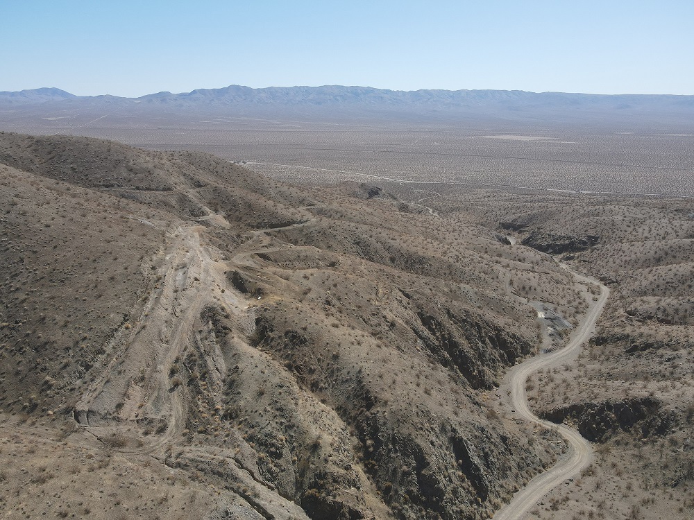
Iron Canyon Flight
Iron Canyon Drone Photo Gallery


I have traveled Garlock Road numerous times over the years but never explored the dirt roads. On this trip I turned right on a dirt road headed to Iron Canyon. The dirt road is in decent shape but it isn’t meant for minivans. At one point I nearly got stuck so I backed up and parked in a small opening.
I launched the drone in the canyon straight up a little over 100ft to get a layout of the land. After seeing the layout I dropped back in the canyon. I started out about 30ft above the ground and began flying through the canyon. Flying around the first two bends was fine but after another 100ft I lost signal with the drone. After increasing altitude to 75ft I was able to move forward again. Just a few minutes later at a range of 3/4 of a mile I lost signal again.
The line of sight when flying the drone became very apparent flying in the Iron Canyon. I had to increase my elevation when I tried flying through the canyon due to signal loss. I want to try this one again in the future and I will hike above the canyon to test the signal.
Iron Canyon has some narrow sections which would make for a great fly through video. Most of my flying on this trip had to be from higher elevation due to signal loss in the canyon.
Summary
I spent about three hours away from the house October 13th, 2021 and flew about 1.5 hours of that. The weather was absolutely perfect for flying with clear skies. This is the best time of year to get out exploring the desert as temperatures are comfortable. The summer months the temps are routinely 105-110 on a daily basis with a few weeks over 110.
See all our videos on our YouTube channel by clicking the YouTube log below. Don’t forget to subscribe to be notified when new videos are uploaded to the channel.
Own a DJI Mavic Air 2 drone and create your own aerial videos and photos.